


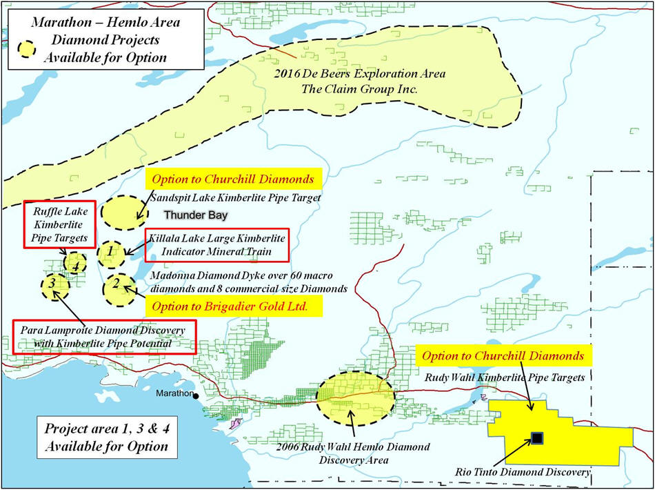
Killala Lake South Property Madonna Diamond Dyke
48 Cell Claim Units Available for Option
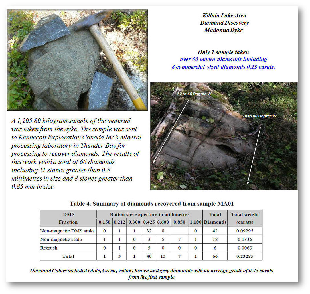
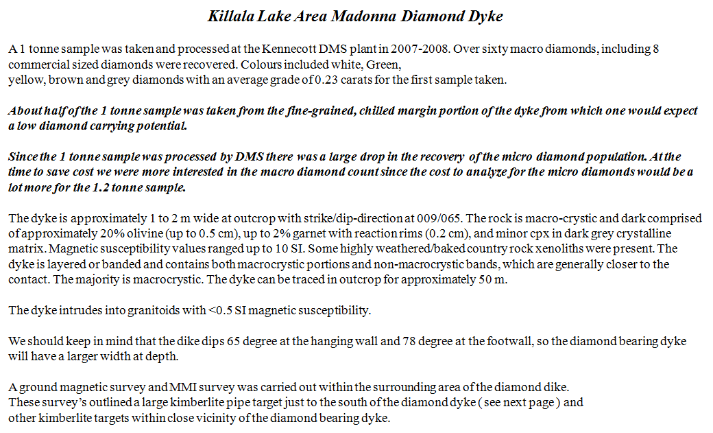
Over 60 macro diamonds including 8 commercial sized diamonds.
The diamonds are white, green, yellow, gray and brown
I have a lot more data that is important and not listed on this site.
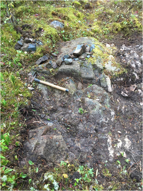
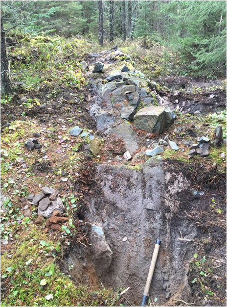
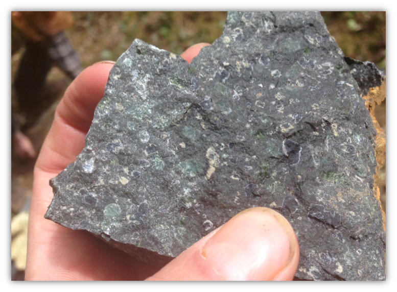
Continued stripping along the Madonna Diamond Dyke October 23, 2017
In 2018 We Diamond drilled 82 meters to the southwest of the Madonna Diamond dyke and intersected the same diamond dyke over 2.78 meters
June 03, 2015 Property visit with District Geologist Dorothy Campbell, Mark Puumalar and two Students from the MNDM Thunder including Dr. Shannon Zurevinski P. Geo. assistant professor from Professor Roger Mitchell from the university of Thunder Bay with her Student Alex and the group from the OGS that is working in the area to see the Madonna Diamond Dyke – kimberlite target #6 and the kimberlite target on the Sandspit Lake property where I discovered the kimblerite group one boulders. Shannon Zurevinski took one of my kimberlite boulders from the Sandspit Lake property for petrographic study including cutting and polish the section, also Shannon took more material from the Madonna diamond dyke as well for petrographic study.
At the Madonna Diamond Dyke June 03, 2015
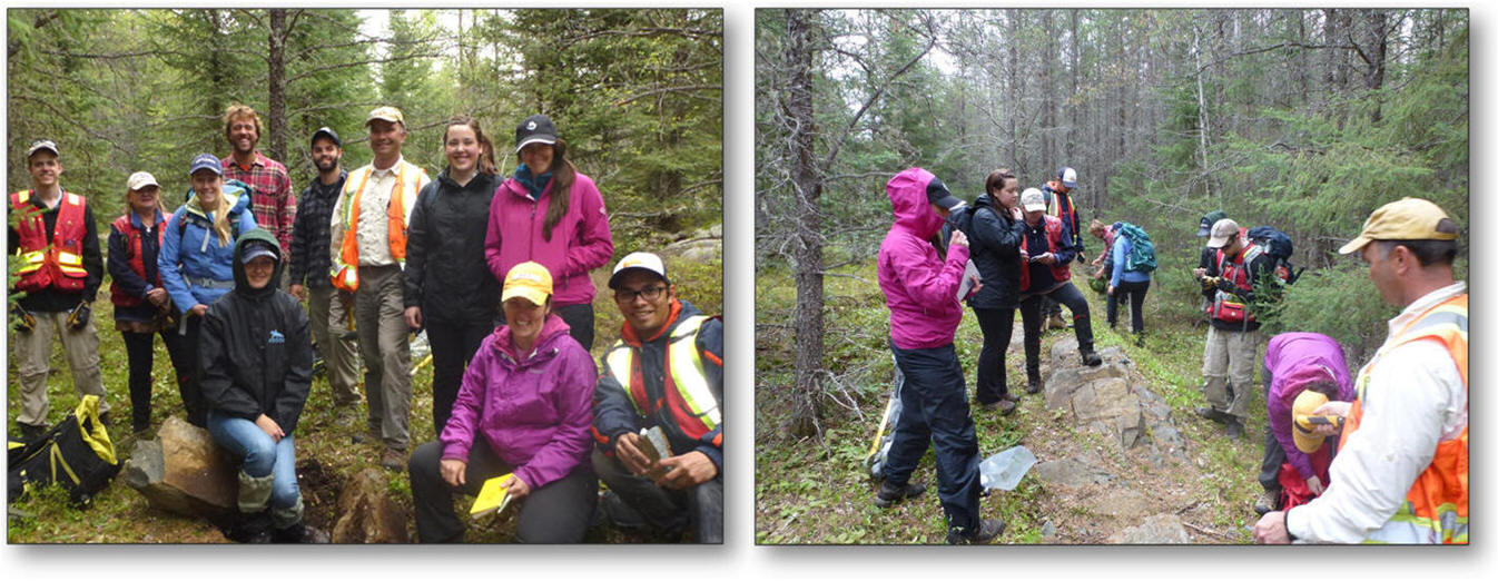
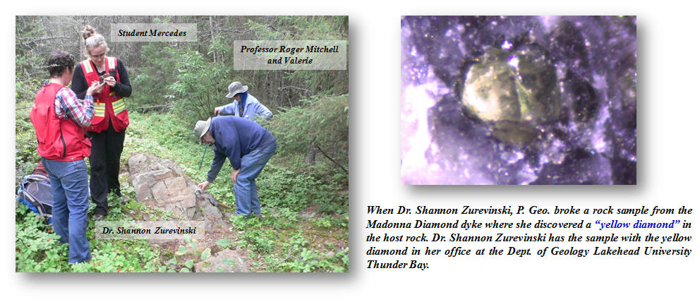
Property Visit at the Diamond Discovery site August 2014 Professor Roger H. Mitchell & Dr. Shannon Zurevinski,
P.Geo Assistant Professor, Dept. of Geology Lakehead University including Professor Roger H. Mitchell’s Wife Valerie
and Student Mercedes.
-
Professor Roger Mitchell Petrographic Report ( Click on Picture to view the Report )
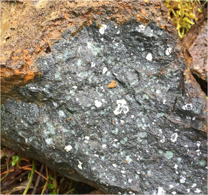
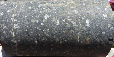
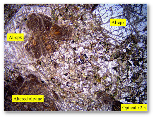
The Madonna dyke showing xenocrystic texture of the dyke
48 Cell Claim Numbers
:
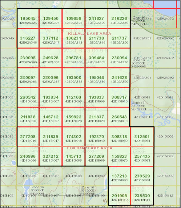
Claim Location Map

Regional Structural Setting
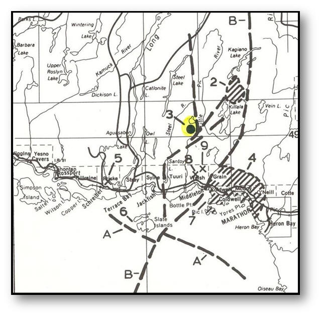
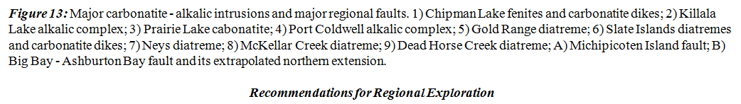
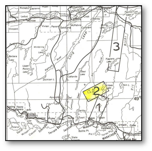
Figure 14: Areas recommended for prospecting for diatreme / kimberlite structures. Areas are numbered in order of decreasing priority.